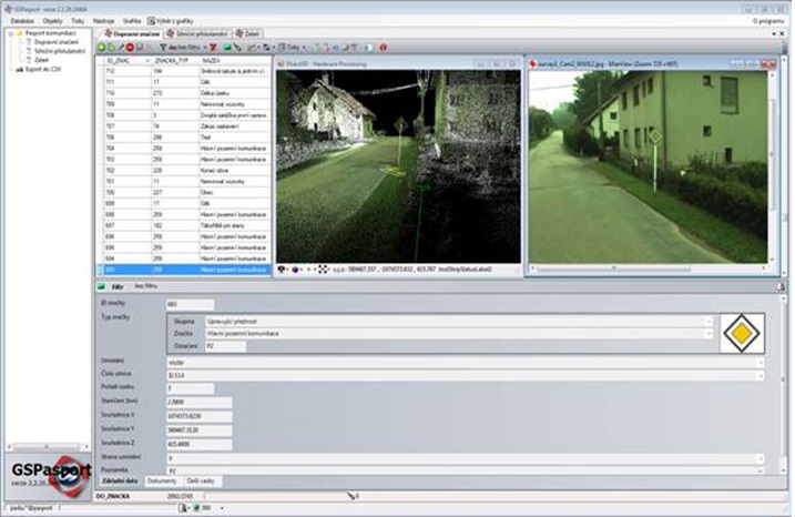
Passportization and inventory
From the point clouds you can evaluate passports of various objects such as passports of public lighting, greenery, traffic signs, street furniture, etc.
Use case
The passport system is a part of the GIS projects.
The data/information for passport is stored in a form of descriptive data, documents and graphical drawings (in a client defined structure.)
The structure may be customized to meet client’s requests.
Passport of traffic signs