Mapping Trolley M6
Unique technology for interior digitization
All-in-one! A new generation of mobile scanning. 3D point cloud and 360 ° panoramic images for detailed reality capture.
The M6 is specially designed for everyday work: it is light, easy to handle and easy to assemble in minutes.
Speed
- The M6 is the fastest mobile interior scanner.
- It is designed for large mapping projects where data quality matters.
- It is equipped with 3 profile scanners and 6 cameras for best results.
- ·Scanning speed is up to 5 times faster than a static scanner.
- ·Up to 25,000 m2 per day.
- ·It can handle any terrain.
Revolution in mobile scanning
-
Complete control over the scanned area.
-
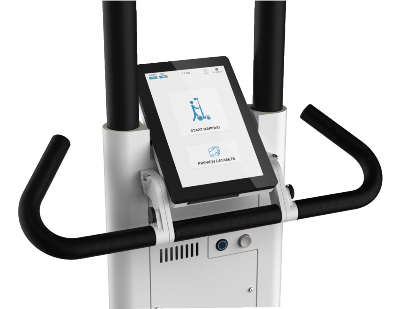
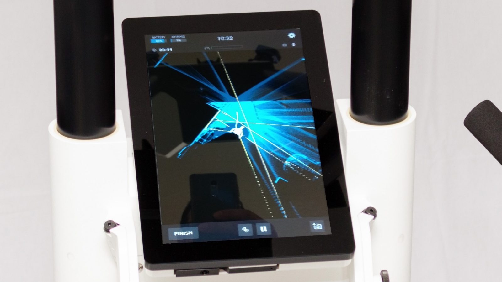
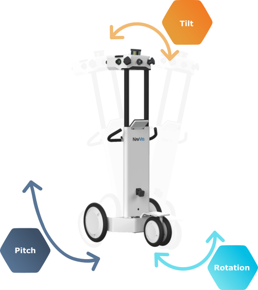
The M6 is controlled by a 10 "tablet on which the targeted area and other important parameters can be clearly seen.
-
·Everything clearly on one screen.
-
·The M6 can handle any tilt.
-
·Measurement refinement using control points.
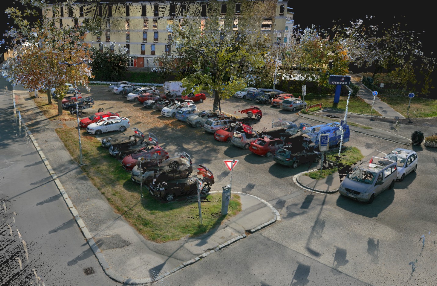
Point Cloud
- The generated point cloud is in RGB.
- When calculating, it is possible to set the point density up to 5 mm.
- Standard formats are - PLY, LAS, E57, XYZ, PTS, PCD .
- Alternatively, it is possible to convert to a suitable format later.
Main equipment
This special mapping trolley is exceptional in its construction.
-
Intuitive tablet control
-
The trolley is controlled by a powerful tablet, which also controls the focused area.
-
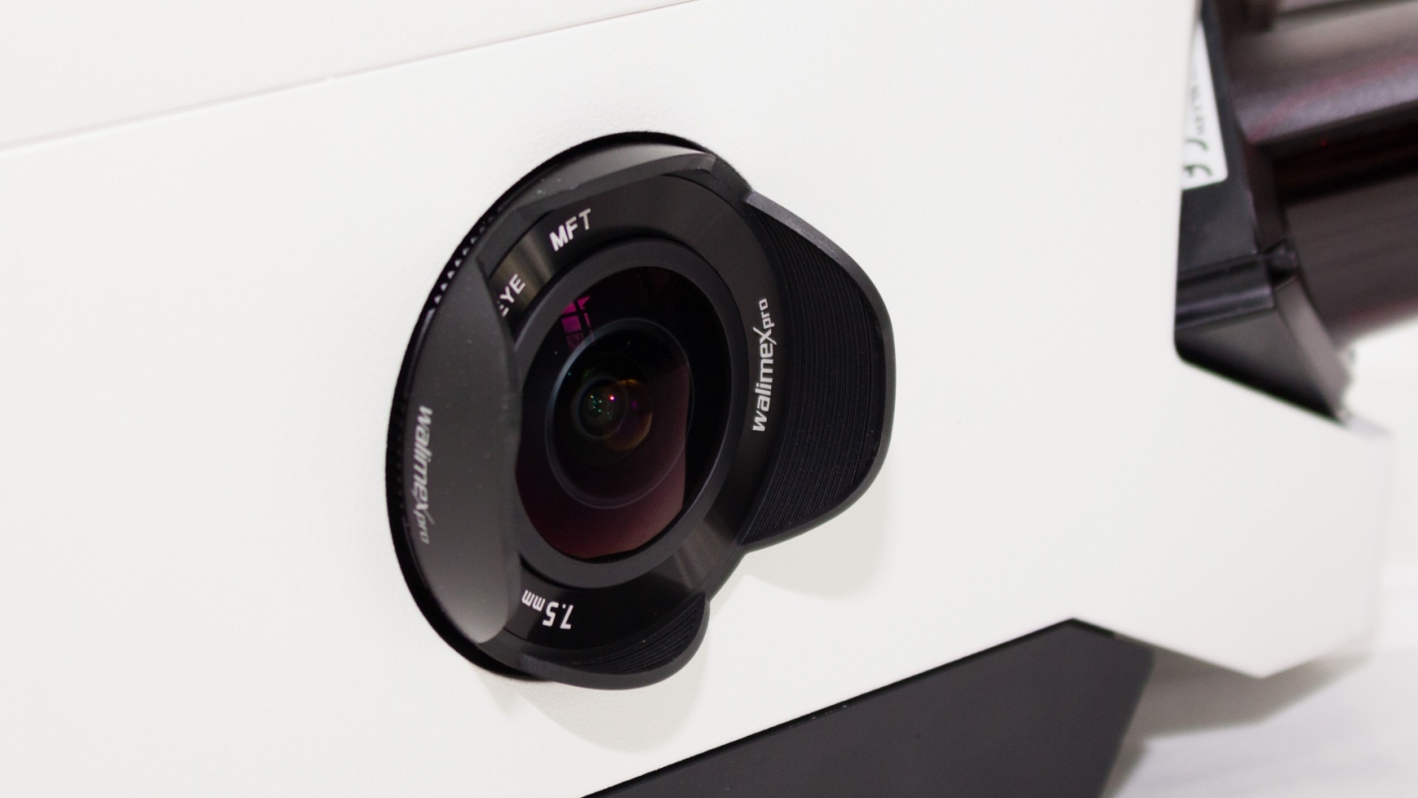
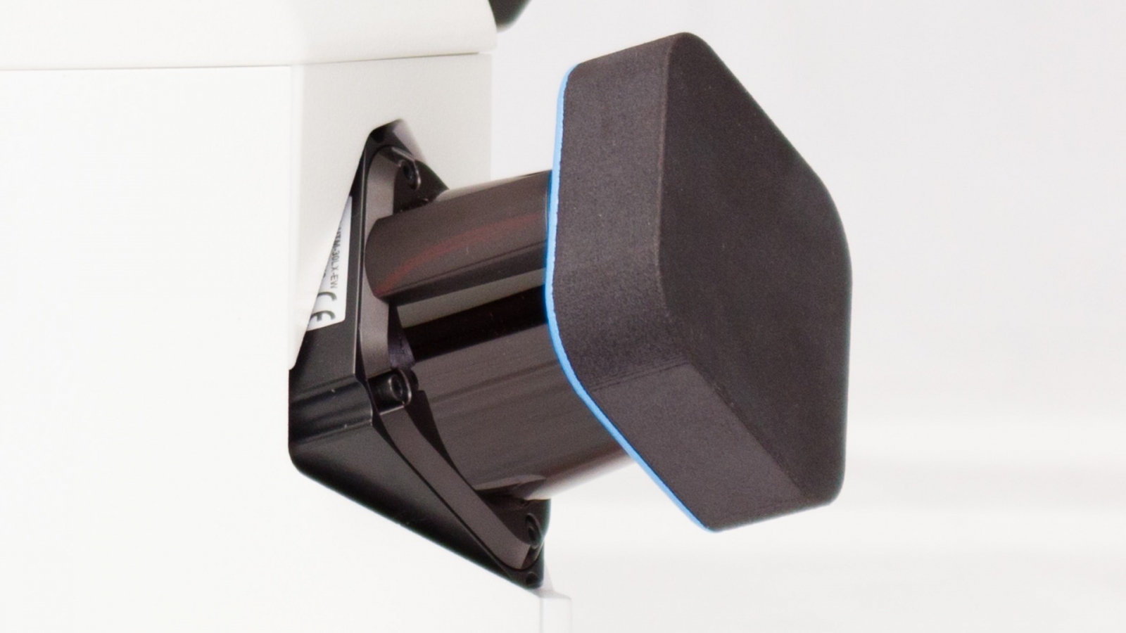
High resolution cameras
-
Panoramic images are generated from 6 high resolution cameras.
-
Powerful laser scanners
-
The M6 trolley is equipped with 3 powerful scanners with a range of up to 30 m, which capture every detail.
6D SLAM
- IMMS M6 is equipped with 3D LiDAR from Velodyne LiDAR Inc. and a powerful inertial unit IMU.
- Velodyne LiDAR in cooperation with IMU enables so-called 6D SLAM - 6 degrees of freedom. This device compensates any tilt.
- Using Velodyne LiDAR, we are able to scan on ramps and even on uneven surfaces such as cobblestones, etc.
Control Points
-
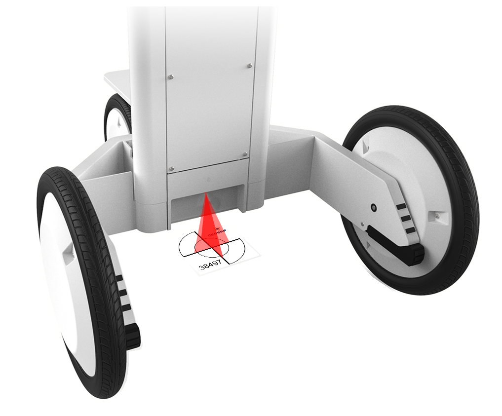
Scanning can be further refined using a network of control points measured by standard geodetic methods.
-
Targets placed on the floor in sufficient density ensure the accuracy of the point cloud.
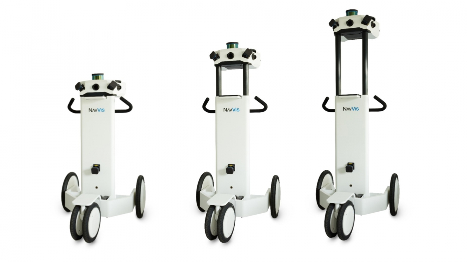
Adjustable height
- During survey, it is possible to adjust the trolley height as needed.
- It is no longer a problem to scan rooms with lowered ceilings or cellars with air conditioning.